
The Ultimate Guide To Pachena Bay: West Coast Trail, Campground & More

Pachena Bay is the location of a beautiful white sandy beach and campground near Bamfield on Vancouver Island. Located in the Pacific Rim National Park, it is also the northern trailhead of the world-famous West Coast Trail. It is either the first or last place hikers will see when completing the incredible multi-day hike.
But if multi-day hiking isn’t your thing, there are still plenty of reasons to visit. With beautiful views, varied marine and wildlife, rainforest trails and water sports, Pachena Beach and the West Coast of Vancouver Island is ideal for the whole family.

Where Is Pachena Bay?
Pachena Bay is located on the Southwest side of Vancouver Island, in British Columbia, Canada. It is 6.5 km (4 mi) south of Bamfield, and neighbours the Huu-Ay-Aht First Nations Village. It is quite a remote destination, but this is partially what makes it such a special place.

How Do You Get There?
Getting to the West Coast of Vancouver Island takes some planning and effort, given that it is somewhat off the beaten path. But rest assured, it’s worth it!
Getting to Vancouver Island
Before making your way to Bamfield or Pachena Bay, you need to get to Vancouver Island. You can travel to Vancouver Island from both Canada and the US.
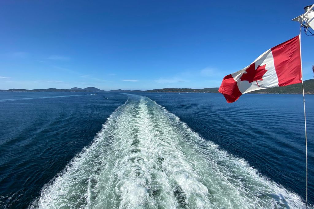
The most common way to get there is by ferry from Vancouver to Nanaimo (Departure Bay) or Victoria (Swartz Bay) with BC Ferries, or from Seattle to Victoria. Getting the ferry is the option I recommend since it allows you to bring your own car.
If you prefer to fly, there are regular flights to Victoria and Nanaimo, departing from Vancouver or Seattle. Although a bit pricier, Pacific Seaplanes also operates a seasonal float plane directly to Bamfield from Vancouver International Airport (YVR). Flights operate from May 8th to September 5th and take about 45 minutes.
Alternatively, there is the option of travelling to Bamfield by private boat if you’re lucky enough to have one! Year-round moorage is available at the Bamfield East Dock.
From Vancouver Island
If you’re already on Vancouver Island, the ship M.V. Frances Barkley departs daily from Port Alberni to Bamfield. This is a scenic 4.5-hour journey, although it first requires you to make your way to Port Alberni.
From elsewhere on Vancouver Island, the only way to get to Pachena Bay is by road.
Can You Drive There?
Once on Vancouver Island, you can drive to Pachena Bay, although this involves taking unpaved gravel roads. There are two routes to get there: via Port Alberni or via Lake Cowichan. Port Alberni is the most direct way, but the route you take will depend on where you’re coming from.
From Nanaimo (via Port Alberni)

The drive from Nanaimo is 170 km and takes about 3 hours.
Travel north on Highway 19, before taking the Highway 4 exit for Port Alberni and Bamfield. From Port Alberni, there will be signs for the Pacific Rim National Park and Bamfield. The final 75 km is the unpaved logging road.
Shortly before you reach Bamfield, you will see a large sign for the Huu-Ay-Aht First Nation’s Campground. Turn left here for the campground and the northern West Coast Trail head.
From Victoria (via Lake Cowichan)

The drive from Victoria is 197 km and takes about 4 hours.
Travel north on Highway 1 for about an hour, before turning left onto Highway 18 just past Duncan. Continue travelling west towards Lake Cowichan where you will start seeing signs for Bamfield. At Lake Cowichan, the road turns into a network of unpaved logging roads for about 120 km.
Continue following the road to Bamfield until you see the sign for the Huu-Ay-Aht First Nation’s Pahena Bay Campground and turn left here.
Navigation
A lot of Vancouver Island has poor cell reception. When travelling to the West Coast, you likely won’t get any cell service at all for most of the journey.
Therefore, it’s important to familiarize yourself with the route ahead of time. You should also download offline maps or take a paper map with you. Make sure your map is up to date, as Vancouver Island’s logging road network is subject to change.
Driving Conditions and Safety
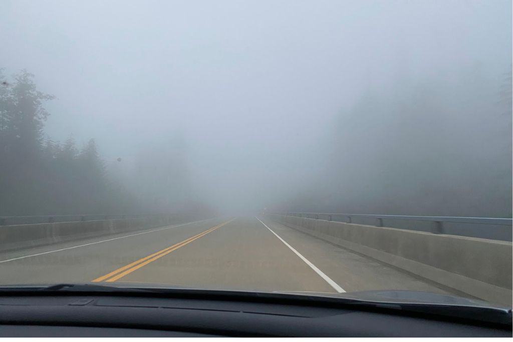
The unpaved roads are slow, bumpy, and very dusty! Having a high-clearance vehicle is recommended for this drive, although it can be done in a regular car. Just keep in mind that when driving on unpaved roads, rocks, gravel and potholes can damage your car.
On this route, it’s best to go slow and drive with headlights on since fog and dust can cause visibility issues. These roads are also used by logging trucks, which have right of way, so drive with caution. To be safe, you should always give way to trucks and fast-moving local traffic.
However, be careful not to get too close to the edge. The shoulders can be soft which has been known to result in accidents. Luckily the roads are generally wide, so it’s possible to let traffic pass without too much difficulty.
Like with any remote drive, always have some supplies with you in case of a breakdown. Make sure your gas tank is full, as for most of the drive there will be nowhere to fill up. It’s also a good idea to know how to change a tire and have a full-sized spare with you since it would be a long wait for roadside assistance!
The good news is that work is currently underway to improve the safety of the road to Bamfield. There are also plans to pave the road in the future.
Shuttle Service – The West Coast Trail Express
If you’re planning on completing the West Coast Trail, or aren’t keen on driving yourself, you can get the West Coast Trail Express, which runs daily between May and September. The shuttle travels between Pachena Bay, Bamfield, Port Renfrew, Gordon River, the Juan de Fuca trailhead, Sooke and Victoria.
The shuttle service is not the most comfortable way to travel, as it’s an old school bus with no air conditioning. But it’s a convenient option and is a great way to connect with other hikers starting or ending their trip.

Parking at the West Coast Trail head
The shuttle service is the easiest way for hikers to get to or from the West Coast Trail head. If driving, hikers will park at one end of the trail and get the shuttle to or from the other end. It’s up to you whether you would prefer to start or finish your hike at your car.
I suggest parking at the southern trailhead (Gordon River, near Port Renfrew), rather than the northern West Coast Trail head (Pachena Bay, near Bamfield), for two reasons.
Firstly, as the road to Pachena Bay is an unpaved gravel road, you risk damaging your car. Being a logging road, it is also more dangerous to drive on than what you’re probably used to.
Secondly, there have been reports in recent years of car break-ins at the West Coast Trail heads. The southern trailhead is considered the safer of the two to leave your car for several days because it is monitored.

Parking at Gordon River (Southern Trailhead)
The parking lot at the southern trailhead is located opposite the Parks Canada office on the Pacheedaht First Nations Reserve. There is also overflow parking by an abandoned house, across the road from the small dock. To park at Gordon River there is a fee of $5 CAD per day and you can pay inside the campground office, located next to the Parks Canada office.
Parking at Pachena Bay (Northern Trailhead)
Parking at the northern West Coast Trail head is free, but it is not monitored. To minimize the risk of break-ins, try to park as close as possible to the Parks Canada office. You should also avoid leaving behind valuables or anything visible in your car. This can be difficult since you probably have items to store in your car while hiking, so at the very least make sure they are concealed.
What Is Bamfield Known For?
Bamfield is a small harbour village of around 200 residents, nestled between Indian reserves, Crown land and the Pacific Rim National Park. Bamfield is most well-known for being at the northern West Coast Trail head, and for its access to pristine marine life and old-growth rainforests.
However, Bamfield is also known for salmon fishing and the world-class Bamfield Marine Sciences Centre. Established in 1972, the Marine Sciences Centre undertakes important research and training. You can visit the centre in the summer for tours, lectures, and classes to learn more about marine biology.
The town is unique in that it is split into two sections on either side of an inlet. To access each side, you need to cross by water taxi. The businesses are mostly on the east side, whereas the homes are on the west side and are connected by a boardwalk.

Bamfield is the closest town to Pachena Bay and has an assortment of shops and restaurants, including a market, café and pub. Visitors to the Pachena Campground will be able to stop at Bamfield for food, drinks and various water activities. Although, if camping at Pacheena Bay, it is recommended to bring supplies with you, due to grocery options in Bamfield being limited.
When Is Pachena Bay Open?
You can travel to the area at any time of year. However, the campground and many of the hiking trails and activities are only open from April to October. The 2023 opening day hasn’t yet been announced, but you can monitor the Pachena Campground Facebook page for updates on when they will open for the season.
When open, their hours are as follows:
| Month | Days | Times |
| April | Monday – Friday | 8:30am – 4:30pm |
| May – June | Monday – Sunday | 8:30am – 5pm* Note – office hours until 8pm on May long weekend |
| July – August | Monday – Sunday | 8:30am – 4:30pm |
| September | Monday – Sunday | 8:30am – 5pm |
If you want to travel to the West Coast of Vancouver Island in winter, you will need to arrange to stay in Bamfield. Although the roads to Bamfield remain open in winter, you should exercise extra caution and expect delays, due to changing weather conditions. You should also check the road conditions before travelling, which you can do here.

Weather By Time Of Year
The weather on the West Coast of Vancouver Island varies a lot by the time of year. The best weather is between the end of May and the end of September.
The warmest months to visit are July and August, closely followed by June. Other times of the year can feel quite cold, largely due to high humidity and frequent rainfall. In the winter months, when temperatures drop, there are chances of snowfall.
Humidity is at its highest in January, reaching nearly 95%. The least humid month is June, at just 56% humidity.
The average weather by time of year is as follows:
| Month | High / Low °C | High / Low °F | Rain |
| January | 8° / 2° | 46° / 35° | 18 days |
| February | 9° / 2° | 48° / 35° | 16 days |
| March | 10° / 3° | 50° / 37° | 17 days |
| April | 12° / 4° | 53° / 39° | 15 days |
| May | 14° / 7° | 57° / 44° | 11 days |
| June | 16° / 9° | 60° / 48° | 9 days |
| July | 18° / 11° | 64° / 51° | 5 days |
| August | 19° / 11° | 66° / 51° | 6 days |
| September | 18° / 9° | 64° / 48° | 8 days |
| October | 14° / 6° | 57° / 42° | 15 days |
| November | 10° / 4° | 50° / 39° | 19 days |
| December | 8° / 2° | 46° / 35° | 19 days |
Pachena Bay Campground
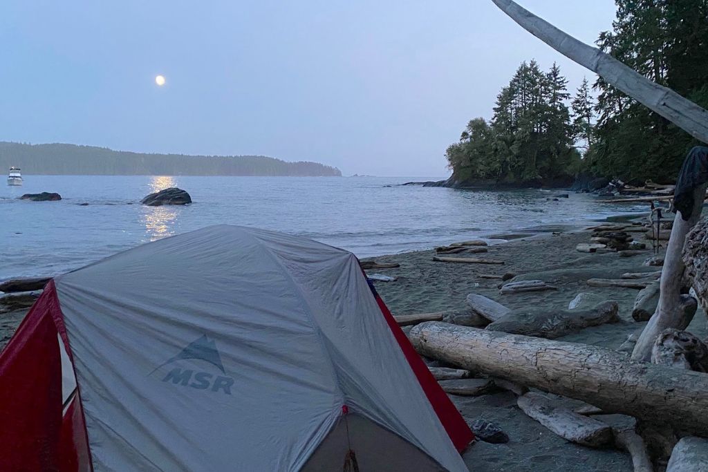
Pachena Bay Campground is operated by the Huu-Ay-Aht First Nations community. The campground is located by the beach, at the mouth of the Pachena River where it meets the Pacific Ocean. The campground is surrounded by old-growth rainforest, immersing campers fully in nature.
The campground offers campers a wilderness escape with access to a variety of facilities. The campground has running water, bathrooms, coin-operated HOT showers, picnic tables and shelter, and fire pits. It also offers campsites for both tents and RVs, with a mix of waterfront and forest sites available.
It is recommended to make reservations for the campground. Reservations can be made online, or by contacting the campground directly.
Pachena Bay Campground rates range from $39.00 to $75.00 CAD (+ taxes). The cost varies depending on whether you opt for a tent or RV site in the forest or beachside, and with regular or premium amenities. Prices also vary from shoulder to peak season (July to early September).
You can find the full list of rates on the Campground website.
Campground Reviews
Recent reviews of the Pachena campground are overwhelmingly positive. Prior to the pandemic, some concerns were shared by visitors about the maintenance of the campground. However, it has been upgraded in recent years with new facilities and RV sites, and the reviews reflect this.
Sites at the campground are on the expensive side for Canada, and the drive is difficult on the unpaved roads. But, despite this, visitors generally believe the Pachena Campground is worth it.
The unique nature of the campground, beautiful views, and the amazing beach, environment, and people, all make it one of the best campgrounds many campers have ever been to.

Campsites
The campsites are well positioned around the campground, including some premium beachfront sites. The sites are mostly sheltered and offer a lot of shade and privacy. Due to the proximity of the sites to the beach, it is easy to walk down for a morning coffee in the sun.
The Beach
Although the beach is on the Pacific Ocean, visitors have been pleasantly surprised by the water, which gets warm enough to swim in later in the summer. The beach is also ideal for kids to explore and dogs to run around since the water goes out quite far at low tide.
Facilities
The upgraded facilities have been well received by visitors and are generally deemed to be clean and well-maintained. There are designated fire pits and firewood can be bought at the Campground office. Fresh water is easily accessible throughout the campground and hot showers cost just $1 for 4 minutes.
There is also free Wi-Fi near the Campground office, which campers find helpful given the poor cell service in the area.
Customer Service
The one negative is that there have been complaints about customer service when trying to book the Pachena Campground. However, with an improved website and new online booking system, hopefully, this will no longer be an issue this season.
Other West Coast Trail Campgrounds
If Pachena Campground is too far for you to go, there are other camping options available to experience southern Vancouver Island. These are also good alternatives for those looking to camp before or after completing their West Coast Trail hike.
Pacheedaht Campground, Port Renfrew
Similar to the Pachena Campground, the Pacheedaht Campground is a beach campground located at a West Coast Trail head.
The Pacheedaht Campground is at the southern trailhead (Gordon River), close to Port Renfrew. You will find the Parks Canada Office located on-site, at the entry to the campground. The campground and Parks Canada Office is almost directly opposite the West Coast Trail head, which you access by getting the ferry from Butch’s Wharf.
The campground and ferry to the trailhead are operated by the Pacheedaht First Nations.
The trailhead parking is also found here and is monitored by campground staff for $5 per day.

The Pacheedaht campground is popular with West Coast Trail hikers and vacationers alike, due to its convenient location and beautiful surroundings. Pacheedaht beach is also a great spot for fishing and crabbing. So you will often find campers enjoying a beach campfire while cooking their catch of the day.
This is an expansive campground with picturesque sites – some even located on the soft sand of Pacheedaht beach. Although some of the sites are close to one another and less private than at Pachena Bay.
Due to how spread out the campsites are, it can be difficult to navigate the Pacheedaht campground. Make sure to check in before heading to your site, and the staff will then be able to direct you to your site.

Pacheedaht Campground Office
Finding the Pacheedaht Campground Office can be a little confusing. It actually doubles as a corner store and is located next to the Parks Canada Office (although the entrance is on the other side).
To get to the office, you will have to drive into the campground, past the first set of campsites and Butch’s wharf. The signage is minimal, but after you see a large sign pointing right to the marina, you will see a smaller sign pointing left to the Pacheedaht Campground. Look out for the small block of buildings with parking spaces and a washroom building at the back of it.
Booking a Site
Given its popularity, it is advisable to book your site in advance, which you can do by emailing the campground directly at campground@pacheedaht.ca. Alternatively, you can try calling them at +1 (250) 647-5414 to make a reservation.
The Pacheedaht First Nations Campground does not have a website. Instead, you can find them on Facebook or look them up on Google Maps. Their address is 305 Pachidah Rd, Port Renfrew, BC V0S 1K0, Canada.
Cowichan Lake
Cowichan Lake is a great alternative to camping on Vancouver Island’s southwest coast. It is on the way to Pachena Bay and Bamfield if coming from Victoria, about a 2-hour drive (85 km) from the Pachena Campground and Bamfield.
Cowichan Lake is a beautiful freshwater lake, about 30 km in length, with several communities along its shores. There are numerous campgrounds dotted around the lake, run by different operators. Reservations are recommended, but some of the campgrounds also offer first-come first served sites.
You can view the different campgrounds by searching the area for campsites on Google Maps.

Cowichan Lake is a great option if you can’t stay near the trailhead the night before or after your West Coast Trail hike and have a long drive home. It is also a great vacation alternative if the Pachena Campground is fully booked for your preferred dates.
Camping on the West Coast Trail
Camping on the West Coast Trail is only permitted with a reservation and spots fill up quickly. You should plan ahead and aim to book your spot as soon as reservations open. Reservations can be made online or by calling Parks Canada.
Note – This year West Coast Trail reservations opened on March 25, 2023 at 8am PDT.
If you are lucky enough to secure a spot on the trail, you will be treated to beautiful beach campsites each night. Camping on the West Coast Trail is a unique experience which allows you to enjoy spectacular views every night and campsite camaraderie with fellow hikers.
Technically, it is possible to camp on most beaches on the West Coast Trail. The exception is between kilometres 35 and 38, due to wildlife activity, and on First Nations reserve lands. However, most hikers will stick to designated campgrounds, which have outhouses and food caches.
TIP: while camping on the West Coast Trail, make sure to consider the tides when pitching your tent. The last thing you want is to get wet or have to move your tent in the middle of the night!

Here is the list of designated West Coast Trail campgrounds and their distances from the northern trailhead:
- Michigan River (12 km / 7.4 mi)
- Darling River (13.8 km / 8.5 mi)
- Orange Juice Creek (15 km / 9.3 mi)
- Tsocowis Creek (16.8 Km / 10.4 mi)
- Klanawa Creek (22.8 km / 14.1 mi)
- Tsusiat Falls (24.9 km / 15.4 mi)
- Cribs Creek (42.5 km / 26.4 mi)
- Carmanah Creek (46.1 km / 28.6 mi)
- Bonilla Point (48 km / 29.8 mi)
- Walbran Creek (53 km / 32.9 mi)
- Cullite Cover (58 km / 36 mi)
- Camper Bay (62.2 km / 38.6 mi)
- Thrasher Cover (70km / 43.4 mi)
Visiting Pachena Bay
There are plenty of activities to do when visiting the Pachena and Bamfield area. Plus, if you want to see marine and wildlife, you’re in luck. The area is full of opportunities to spot bears, eagles, cougars, seals, and whales during the migration season!
In summer, the area is known for hiking, beachcombing, and water sports such as boating, surfing, and scuba diving. Bamfield also offers excellent sport fishing opportunities, and in the winter it is a great spot for storm watching.
Hiking
Hiking is of course one of the most popular activities to do in the area.
For an easy hike, there is a rainforest boardwalk leading from Pachena Beach straight to the West Coast Trailhead. This is a beautiful walk to do, and you might even get to congratulate some tired hikers coming off the West Coast Trail. Although keep in mind you won’t be able to hike the West Coast Trail yourself without a reservation and permit.

But the famous West Coast Trail is not the only hike worth doing near Pachena and Bamfield!
Cape Beale Lighthouse and Keeha Beach
There are other nearby trails to explore, which don’t require reservations or permits. In particular, the hike to the Cape Beale Lighthouse is particularly stunning.
This is a 14 km out-and-back hike through lush rainforest. But be prepared, this is a strenuous hike, and you will need to monitor the tides. If the tides are high, you may not be able to make it to the end of the trail.
An easier option is the Keeha Beach hike, which is a relatively flat 7 km round trip. This is a rewarding hike as at the end you will get to enjoy beautiful Keeha Beach, and you might even get it all to yourself.
Both the Cape Beale Lighthouse and Keeha Beach hikes start at the same trailhead. The start of the trails is just south of Bamfield, and you can park 400m north of the trailhead.

Preparation and Safety
Beware that the terrain on both these hikes can get very muddy, and there are lots of fallen trees. Therefore, you should always hike with proper hiking boots, trekking poles and first aid essentials. And don’t forget to take plenty of water!
It is also important to watch out for wildlife when hiking on Vancouver Island. There are black bears and cougars in the area, so it is recommended to carry bear spray and never leave food unattended (unless stored correctly in bear caches).
Pachena Bay Festival
Not only is the Pachena area home to an array of outdoor activities, it is also making a name for itself in the festival scene. The Pachena Bay Festival, which debuted last year, is returning in 2023 and is set to be even bigger and better.
This festival is not only a celebration of music but also an opportunity to learn, grow and connect with nature. As far as music festivals go, this one is on the more adventurous side. Even the journey to get there counts as an adventure!
The Festival is a 2-night, 3-day event. It offers attendees the chance to camp, dance the night away, and attend workshops and off-site adventures, all while enjoying world-class music acts and beach parties.

Set amidst an old-growth rainforest and a beautiful sandy beach, the Festival prides itself on hosting the event in one of the best places on earth.
There will be a variety of vendors on sight at the festival. These will include food and artisanal vendors, cultural, scientific and movement workshops, art and design installations, and wellness practitioners.
Tickets are on sale online for $300 per person and include a weekend pass to the festival and onsite camping. Families are welcome to attend the festival, with free entry for children 12 and under. A limited number of dogs are also welcome at the festival.
Surfing
If you’re a keen surfer, it is worth bringing your board when visiting Pachena Beach. Although it isn’t the most popular or consistent surf spot on Vancouver Island, there are some excellent waves off Pachena Beach.
Because not many surfers will make the difficult journey to Pachena Beach, it is a quieter spot for surfing, so you get the waves to yourself. Plus there is plenty of coastline to enjoy – the bay itself is 1 km wide and 3 km in length.
Although Pachena Beach might not be a spot you would specifically travel to just to surf, it is definitely an activity worth doing while visiting.
One of Vancouver Island’s most idyllic and remote surf spots – Keeha Beach – is also nearby. As mentioned above, this beach is accessible by a 7km roundtrip hike from Bamfield.
Shipwrecks
The final noteworthy activity to do when visiting Pachena area is to check out some of Vancouver Island’s famous shipwrecks. However, this is an activity which will require hiking a portion of the West Coast Trail, therefore obtaining a permit is a must.
There are so many shipwrecks along Vancouver Island’s southwest coast that the area has become known as the ‘Graveyard of the Pacific’. In fact, this is part of the history of the West Coast Trail, which was originally created as an escape route for shipwreck survivors.

The Valencia
The creation of the trail came about following the particularly devastating sinking of the Valencia in 1906. The ship had set out from San Francisco and was bound for Alaska, via Victoria. Out of the 110 passengers and 65 crew, there were only 37 survivors.
The sinking of the Valencia was a particularly unique tragedy. The ship actually took 36 hours to sink and was only 80 metres from shore (the captain had ordered it beached after it crashed into a rock). Panic set in when the electricity cut out, which led to chaos with the lifeboats and resulted in them capsizing.
If you are lucky enough to secure a reservation for the West Coast Trail, you will be able to see a small portion of the Valencia at km 18 from the northern West Coast Trail head. You can also comb the beach for more remains of the notable ship.
The Uzbekistan
Another ship to look out for is the Uzbekistan. It is located about 5 km before you reach the Valencia.
The Uzbekistan actually ran straight ashore in 1943. It is unknown why this crash happened, but one theory is that a lighthouse blackout in effect at the time led to the disaster. Fortunately, all 50 crew survived, but were forced to abandon ship.
What is left of the Uzbekistan can be found at km 13 from the trail head, where portions of the hull are still visible. If you search the beach at low tide you may also find more debris belonging to the Uzbekistan.
The Michigan
The Michigan is the closest West Coast Trail shipwreck to the northern trail head. Located at km 12, it can be found about 2 km east of Pachena Point.
This ship fell victim to a northerly current when it was on its way to San Francisco in 1893. The current pushed the Michigan into Vancouver Island, which is a common source of demise for ships in the Graveyard of the Pacific. Luckily most of the crew survived the incident, with only one crew member succumbing to exposure.
Given the ship sank 130 years ago, some of the wreckage can still be seen on the west coast. In particular, keep an eye out for the huge boiler that sits alone on a rocky ledge, constantly beaten by waves.

Conclusion: Pachena Bay & The West Coast Trail
A true gem of Vancouver Island, Pachena Bay is well worth the journey to get there!
Even if you aren’t hiking the West Coast Trail, exploring, and camping at beautiful Pachena Beach will give you a great taste of what the west coast has to offer. Hopefully, this guide will help you in making your travel plans, so you can make the most of your visit.
READ MORE
The best Things To Do On Vancouver Island: 21 Unique & Fun Experiences
Ferry To Nanaimo: Price, Schedule & Everything You Need To Know
West Coast Trail in Canada: The Ultimate Hiking Guide